#Product Trials
ME120 USV Conduct Multibeam Survey in Wanjiazhai Reservoirs
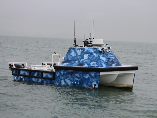
ME120 Unmanned Surface Vehicle Deployed with Kongsberg M3 multibeam echo sounder system
1. About the survey area
(1) The reservoir of Wanjiazhai hydropower station
The valley the Wanjiazhai hydro station reservoir located is very deep and stretches alongside mountain foot in a u shape. The valley is about 430 meters wide, while its river surface is 200 meters wide. The riverbed cover is between 0~2m thick, and the bedrocks of the main riverbed are bare. The banks on both sides of the reservoir are composed of Cambrian limestone, dolomite, marl and shale, the lithology of which is dense and hard.
(2) The reservoir of Longkou hydropower station
The water area it controls is 397,406 square kilometers. The drainage area of Wanjiazhai-Longkou is 260 square kilometers, accounting for 0.65% of the controlled watershed area.
2. Survey area and monitor section setting
(1) The Wanjiazhai reservoir survey area is set on the upper reach of the Wanjiazhai dam, a total length of 14km, covering 0.7km of the Yangjiawan tributary
(2) The Longkou reservoir survey area is on the upstream of Longkou dam, total of 5km along the bank line.
3. Filed Operation
The USV was equipped with a MBES and a high-precision inertial navigation system. To ensure full coverage of the whole survey area, the survey line spacing was adjusted according to the water depth .
During the operation, the survey area was divided into smaller sections according to different terrains and working progress. In each small survey area, the survey lines were arranged parallel to the shoreline, and the USV sailed back and forth to scan the riverbed. In the shallower area, additional lines were set to ensure the terrain was fully covered. The following principles were applied when planning the survey lines.
(1) Survey lines are set in parallel. Lines in the same area should be parallel to each other, and the direction should be consistent with the underwater contour lines. This can maximize the range of the lines and expand the scanning coverage.
(2) The scanning range of each line should overlap. When mapping with a multi-beam echo sounder system, there is a signal interference area at the edge of the sonar beams. Therefore, it is required that the scanning range of adjacent lines must have a certain overlap area to secure clear data collection.
(3) A survey line should not be too long. When the survey area is spacious it’d better be divided into relatively smaller parts and survey each area independently. As the water depth in a reservoir is usually deep in the middle and shallow in the sides, the density of survey lines should be increased from the middle to the sides. A basic principle is make sure the line spacing can secure a scan range of up to 3 times the water depth.
(4) Densify the survey lines when surveying the complex areas. The density of the lines is positively correlated with the mapping accuracy, so the line density should be increased in complex areas to improve the mapping resolution.
4. Indoor processing
4.1 Data Post-processing
In this project, an M3 MARSEC software comes with the MBES system controlled the MBES system in real-time. A MV-POS View Controller v9.21 software took care of the navigation and positioning system, the attitude compass system and the clock synchronization system in real-time. The M3 MARSEC software monitored real-time data from MBES system and conducted simple post-processing during the filed survey. All of the above operations were carried out on one platform —the USV control computer.
After the field surveying, surveyors used a Caris (HIPS and SIPS) v10.0.2 software to post-process the data, including tide level correction, line editing, surface model synthesis, surface editing, Data output, etc. A 20cm grid 3D map was generated.
4.2 Contour Line Processing
Extracted data points every 10 meters from the processed raw data to generate a underwater topographic contour map according to the actual coordinate position. The height contour distance is 1 meter.
4.3 Section data extraction and Sectional view generation
Basing on the processed multi-beam data, a sectional view is generated according to the coordinate position of the sections which had been monitored from years ago.
5. Data Comparison
The management department of the reservoirs has been using the sectional survey to monitor the hydro project for years, that is, using a total station, single beam sounder and RTK GPS system to survey target sections.
In this project, the sectional data extracted from the USV multibeam data is compared with the existing sectional data to verify the validity and accuracy of the former.
After comparing data of different sections, it can be seen that the overall trends of the sectional views from both survey methods are generally identical. The USV multi-beam data is highly consistent with the existing elevation data. The minimum deviation is 0.04m, the maximum deviation is 1.9m, and the deviation range is between -0.02% and +0.19%.
6. The meaning of surveying theunderwater terrain of reservoirs
Surveying the underwater terrain of the reservoirs precisely and scientifically bears great significance. It can comprehensively implement the sediment monitoring and storage survey to the reservoirs, which would facilitate the management to conduct efficient production management and water transfer planning. Monitor the loss and losing process of the reservoir capacity can provide accurate storage capacity data to support the formulation of a scientific water transfer plan.
7. Conclusion
From the perspective of actual efficiency and cost, the application of USV with multi-beam system for underwater topographic survey is worthy of widespread promotion. In the future, USV can be combined with laser scanners and drones to further improve survey efficiency and coverage.
For data sheets, please click: https://www.oceanalpha.com/application_cases/me120-usv-conduct-multibeam-survey-in-wanjiazhai-reservoirs/